


Favourite
Tarbes
| Municipality | Marquerie |
|---|---|
| Postcode | 65350 |
| Latitude | 43.2597230 (N 43° 15’ 35”) |
| Longitude | 0.2033940 (E 0° 12’ 12”) |
| Altitude | From 222m to 337m |
| Surface area | 3.46 km² |
| Population | 85 inhabitants |
| Density | 24 inhabitants/km² |
| Prefecture | Tarbes (13.7 km, 23 min) |
| Insee code | 65298 |
| Intercommunality | CC des Coteaux du Val d'Arros |
| Department | Hautes-Pyrénées |
| Territories | Gascony, Midi-Pyrénées, Pyrenees |
| Region | Occitanie |
| Coussan | 2.4 km (4 min) |
|---|---|
| Cabanac | 3.5 km (7 min) |
| Hourc | 3.8 km (7 min) |
| Aubarède | 4 km (8 min) |
| Pouyastruc | 4.1 km (7 min) |
| Souyeaux | 4.4 km (7 min) |
| Goudon | 5.1 km (7 min) |
| Gonez | 5.9 km (9 min) |
| Laslades | 6.1 km (10 min) |
| Collongues | 6.4 km (10 min) |
| Moulédous | 6.5 km (9 min) |
| Castelvieilh | 6.9 km (10 min) |
| Sinzos | 7 km (9 min) |
| Peyriguère | 7.4 km (15 min) |
| Last name | Activity type | Rate | City |
|---|---|---|---|
 | Sports sensations | 39 € to 70 € | Bagnères-de-Bigorre (22 km) |
 | Sports sensations | 15 € to 25 € | Lannemezan (23 km) |
 | Sports sensations | 45 € | Campan (27 km) |
 | Culture and education | 200 € to 350 € | Lourdes (27 km) |
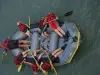 | Sports sensations | 32 € to 57 € | Lestelle-Bétharram (36 km) |
| Last name | Outing type | Difficulty | Duration | Departure municipality |
|---|---|---|---|---|
 | Hike | Easy | 2:00 | Ossun (21 km) |
 | All-terrain bike itinerary | Easy | 1:00 | Bagnères-de-Bigorre (22 km) |
 | Cycling itinerary | Athletic | 3:55 | Bagnères-de-Bigorre (22 km) |
 | Cycling itinerary | Intermediate | 3:45 | Bagnères-de-Bigorre (22 km) |
 | Cycling itinerary | Intermediate | 4:00 | Bagnères-de-Bigorre (22 km) |