


Favourite
The site of Saint-Nazaire
| Municipality | Margerides |
|---|---|
| Postcode | 19200 |
| Latitude | 45.4563710 (N 45° 27’ 23”) |
| Longitude | 2.4035700 (E 2° 24’ 13”) |
| Altitude | From 475m to 737m |
| Surface area | 11.80 km² |
| Population | 315 inhabitants |
| Density | 26 inhabitants/km² |
| Prefecture | Tulle (72 km, 53 min) |
| Insee code | 19128 |
| Intercommunality | CC Haute-Corrèze Communauté |
| Department | Corrèze |
| Territories | Limousin, Massif Central |
| Region | New-Aquitaine |
| Saint-Victour | 3.9 km (7 min) |
|---|---|
| Veyrières | 4.5 km (7 min) |
| Saint-Bonnet-près-Bort | 7.6 km (14 min) |
| Roche-le-Peyroux | 7.9 km (13 min) |
| Sarroux - Saint Julien | 10.3 km (14 min) |
| Saint-Exupéry-les-Roches | 10.6 km (14 min) |
| Mestes | 10.7 km (13 min) |
| Bort-les-Orgues | 11.9 km (12 min) |
| Saint-Étienne-la-Geneste | 13 km (14 min) |
| Thalamy | 13.3 km (15 min) |
| Liginiac | 13.3 km (23 min) |
| Valiergues | 13.7 km (14 min) |
| Saint-Fréjoux | 14.4 km (21 min) |
| Chirac-Bellevue | 14.9 km (14 min) |
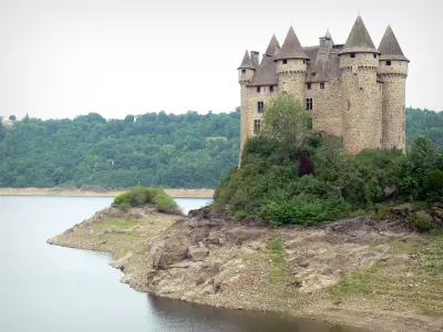
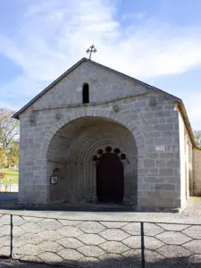
| Monuments |
|---|
| Last name | Activity type | Rate | City |
|---|---|---|---|
 | Sports sensations | 20 € | Lanobre (8.2 km) |
| Last name | Outing type | Difficulty | Duration | Departure municipality |
|---|---|---|---|---|
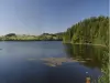
 | Hike | Intermediate | 2:00 | Veyrières (13.2 km) |
 | Hike | Intermediate | 2:30 | Saint-Genès-Champespe (25 km) |
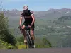 | Cycling itinerary | Intermediate | 40 min | Picherande (29 km) |
 | Cycling itinerary | Intermediate | 20 min | Murat-le-Quaire (32 km) |
 | Cycling itinerary | Athletic | 35 min | Mont-Dore (35 km) |