Liven up your holidays!

Marcillé-Robert

Tourism, holidays & weekends guide in the Ille-et-Vilaine

Marcillé-Robert - Tourism, holidays & weekends guide in the Ille-et-Vilaine
8.8
6

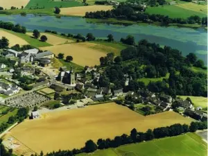
Village of Ille-et-Vilaine, in the district of Fougères-Vitré, Marcillé-Robert takes place at about thirty kilometers from Rennes, near Visseiche, Retiers and Essé. It is located near Le Theil-de-Bretagne, in the heart of the Armorican Massif.

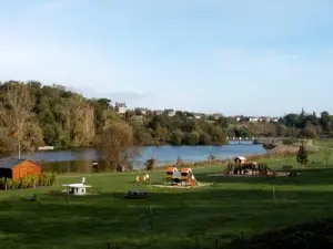
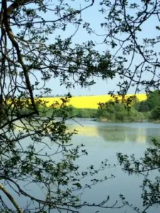
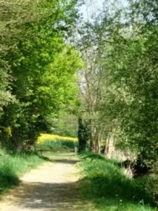
Breton city very old, Marcillé-Robert was already beating the currency in the seventh century. Fortified in the 15th century, it still attracts visitors today thanks to a rich and preserved natural heritage.

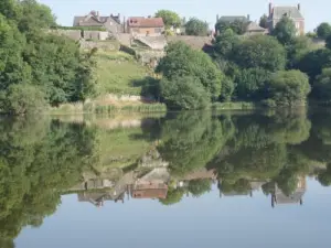
Marcillé-Robert also has an interesting architectural and historical heritage dating back several centuries and testifying to the wealth of the city over time.

Geographical information

MunicipalityMarcillé-Robert
Postcode35240
Latitude47.9495069 (N 47° 56’ 58”)
Longitude-1.3591570 (W 1° 21’ 33”)
AltitudeFrom 37m to 87m
Surface area20.30 km²
Population970 inhabitants
Density47 inhabitants/km²
PrefectureRennes (35 km, 45 min)
Insee code35165
IntercommunalityCC Roche aux Fées Communauté
DepartmentIlle-et-Vilaine
RegionBrittany

Nearest cities & towns

Visseiche4.4 km (6 min)
Boistrudan4.6 km (7 min)
Retiers5.1 km (6 min)
Essé5.3 km (8 min)
Arbrissel7 km (11 min)
Moulins7 km (8 min)
Moussé9.4 km (14 min)
Le Theil-de-Bretagne9.7 km (14 min)
Bais10.3 km (14 min)
La Guerche-de-Bretagne10.4 km (13 min)
Coësmes11.3 km (13 min)
Janzé11.5 km (15 min)
Rannée11.8 km (15 min)

Things to see and do

Built between the seventeenth and the nineteenth century, the church Saint-Ouen has on its south facade a porch with ossuary. Inside, it is possible to admire a wooded vault and beautiful paintings restored in the apse. Do not miss to stop in front of the altarpiece of the early nineteenth century with its twisted columns adorned with foliage.

In the city, it is possible to discover the Gothic castle of the nineteenth century or the ruins of the medieval castle from the eleventh to the fifteenth century.

Lovers of outdoor life will take the direction of the pond of hundred hectares fed by the Seiche and the Ardennes, and to observe many migratory birds. There are also playgrounds and picnic tables. The 2.5 km interpretation trail allows you to discover all the heritage of the town.

Places of interest

Natural sites

Events and festivities

Photos

Pedalos
Pedalos
See photo
panoramic view of the pond
See photo
aerial view of the village
See photo
children 's playground
See photo
Summer Landscape
Summer Landscape
See photo
Summer Reflections in Rachapt
See photo
Swan and cormorants in winter
See photo
Spring Landscape
Spring Landscape
See photo
Landscape autumn
Landscape autumn
See photo
equipped trail at the edge water
See photo
La Seiche
La Seiche
See photo

Weather

Tuesday 23 april
Min. 2°C - Max. 11°C
Day
Night
Wednesday 24 april
Min. 4°C - Max. 14°C
Day
Night
Thursday 25 april
Min. 3°C - Max. 14°C
Day
Night

Visits, leisure and activities nearby

Outings

Last nameOuting typeDifficultyDurationDeparture municipality
Piré-sur-Seiche: Path of the Squirrel
HikeIntermediate3:00Piré-Chancé (8 km)
Châteaugiron: From Glaume to Gervis
HikeIntermediate2:45Châteaugiron (15.1 km)
Bike Promenade® in Rennes Country No.9
All-terrain bike itineraryIntermediate2:05Châteaugiron (15.2 km)
Velo Promenade in Rennes Country No.10
All-terrain bike itineraryIntermediate2:05Châteaugiron (15.4 km)
Greenway (Voie verte)
Cycling itineraryEasy1:15Rougé (19.6 km)

Restaurants

Bed & breakfasts

Vacation rentals

Campsites

Hotels

Your holidays
A hotel
A vacation rental
A bed & breakfast
A campsite
A leisure activity
A restaurant
A rental car
A plane ticket
By continuing to browse our site, you are agreeing to the use of cookies to improve your experience and make targeted offers.
Find out more and make settings
Your account