Favourite
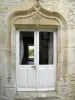
Argenton-sur-Creuse
| Municipality | Luzeret |
|---|---|
| Postcode | 36800 |
| Latitude | 46.5405120 (N 46° 32’ 26”) |
| Longitude | 1.3941360 (E 1° 23’ 39”) |
| Altitude | From 128m to 192m |
| Surface area | 26.78 km² |
| Population | 156 inhabitants |
| Density | 5 inhabitants/km² |
| Prefecture | Châteauroux (43 km, 34 min) |
| Insee code | 36106 |
| Intercommunality | CC Brenne - Val de Creuse |
| Department | Indre |
| Territory | Berry |
| Region | Centre-Loire Valley |
| Chazelet | 6.4 km (9 min) |
|---|---|
| Saint-Civran | 6.6 km (12 min) |
| Sacierges-Saint-Martin | 7.5 km (14 min) |
| Prissac | 7.6 km (9 min) |
| Roussines | 9.9 km (16 min) |
| Vigoux | 10.2 km (16 min) |
| Thenay | 11.1 km (13 min) |
| Saint-Gaultier | 12 km (15 min) |
| Celon | 12.5 km (21 min) |
| Saint-Gilles | 13 km (18 min) |
| Oulches | 13.1 km (20 min) |
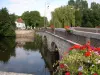
| Argenton-sur-Creuse | 13.2 km (17 min) |
| Rivarennes | 14.1 km (17 min) |
| Dunet | 14.5 km (17 min) |
| Natural sites |
|---|
| Last name | Outing type | Difficulty | Duration | Departure municipality |
|---|---|---|---|---|
 | Car itinerary | Easy | 45 min | Saint-Sébastien (19.7 km) |
 | Hike | Easy | 2:30 | Thollet (25 km) |
 | Car itinerary | Easy | 1:00 | La Trimouille (28 km) |
 | Hike | Intermediate | 1:45 | La Trimouille (28 km) |
 | Car itinerary | Easy | 1:00 | La Trimouille (28 km) |