
Favourite
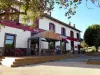
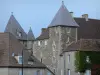
Veauce
| Municipality | Louroux-de-Bouble |
|---|---|
| Postcode | 03330 |
| Latitude | 46.2258240 (N 46° 13’ 33”) |
| Longitude | 2.9806290 (E 2° 58’ 50”) |
| Altitude | From 357m to 550m |
| Surface area | 16.87 km² |
| Population | 235 inhabitants |
| Density | 13 inhabitants/km² |
| Prefecture | Moulins (62 km, 58 min) |
| Insee code | 03152 |
| Intercommunality | CC Saint-Pourçain Sioule Limagne |
| Department | Allier |
| Territories | Auvergne, Bourbonnais, Massif Central |
| Region | Auvergne-Rhône-Alps |
| Coutansouze | 4.5 km (8 min) |
|---|---|
| Chirat-l'Église | 5.8 km (9 min) |
| Vernusse | 7.5 km (13 min) |
| Échassières | 8.1 km (13 min) |
| Nades | 9.2 km (14 min) |
| Blomard | 10.8 km (18 min) |
| Lalizolle | 10.9 km (16 min) |
| Lapeyrouse | 11.6 km (18 min) |
| Moureuille | 11.9 km (18 min) |
| Bellenaves | 12 km (17 min) |
| Target | 12.2 km (19 min) |
| Veauce | 12.6 km (19 min) |
| Durmignat | 13.1 km (20 min) |
| Servant | 14 km (20 min) |
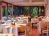
| Last name | Activity type | Rate | City |
|---|---|---|---|
 | Nature and the great outdoors | 8 € to 50 € | Noyant-d'Allier (30 km) |
 | Nature and the great outdoors | 7 € | Chapdes-Beaufort (38 km) |
 | Nature and the great outdoors | 140 € to 240 € | Volvic (40 km) |
| Last name | Outing type | Difficulty | Duration | Departure municipality |
|---|---|---|---|---|
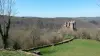
 | Hike | Easy | 1:30 | Valignat (9.3 km) |
 | Village visit | Easy | 1:00 | Servant (10.4 km) |
 | Hike | Intermediate | 1:30 | Chantelle (13.2 km) |
 | Hike | Intermediate | 1:30 | Saint-Rémy-de-Blot (17 km) |
 | Hike | Easy | 20 min | Aigueperse (28 km) |