
Favourite
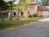
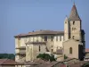
Auch
| Municipality | Leboulin |
|---|---|
| Postcode | 32810 |
| Latitude | 43.6688890 (N 43° 40’ 8”) |
| Longitude | 0.6605600 (E 0° 39’ 38”) |
| Altitude | From 124m to 258m |
| Surface area | 8.91 km² |
| Population | 357 inhabitants |
| Density | 40 inhabitants/km² |
| Prefecture | Auch (9.4 km, 13 min) |
| Insee code | 32207 |
| Intercommunality | CA Grand Auch Cœur de Gascogne |
| Department | Gers |
| Territories | Gascony, Midi-Pyrénées |
| Region | Occitanie |
| Lahitte | 3 km (6 min) |
|---|---|
| Montégut | 4.4 km (11 min) |
| Montaut-les-Créneaux | 6.4 km (10 min) |
| Marsan | 6.5 km (10 min) |
| Nougaroulet | 7.5 km (11 min) |
| Auch | 8.7 km (15 min) |
| Lussan | 9.4 km (16 min) |
| Preignan | 10.9 km (14 min) |
| Duran | 11.1 km (12 min) |
| Aubiet | 12.3 km (15 min) |
| Crastes | 12.3 km (17 min) |
| Ansan | 12.6 km (18 min) |
| Pavie | 12.6 km (19 min) |
| Pessan | 13.2 km (17 min) |
| Last name | Activity type | Rate | City |
|---|---|---|---|
 | Local flavours | Free | Larroque-sur-l'Osse (46 km) |
| Last name | Outing type | Difficulty | Duration | Departure municipality |
|---|---|---|---|---|
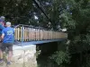 | Hike | Intermediate | 3:25 | Castelnau-Barbarens (11.6 km) |
 | Hike | Easy | 2:30 | Bazian (27 km) |
 | Hike | Easy | 35 min | Lombez (30 km) |
 | Hike | Easy | 1:40 | Aignan (47 km) |
 | All-terrain bike itinerary | Intermediate | 6:45 | Valence (52 km) |