


Favourite
Devesset Lake
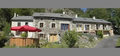
| Municipality | Le Mas-de-Tence |
|---|---|
| Postcode | 43190 |
| Latitude | 45.1211820 (N 45° 7’ 16”) |
| Longitude | 4.3586020 (E 4° 21’ 31”) |
| Altitude | From 936m to 1153m |
| Surface area | 12.83 km² |
| Population | 159 inhabitants |
| Density | 12 inhabitants/km² |
| Prefecture | Le Puy-en-Velay (53 km, 1:00) |
| Insee code | 43129 |
| Intercommunality | CC du Haut-Lignon |
| Department | Haute-Loire |
| Territories | Auvergne, Massif Central |
| Region | Auvergne-Rhône-Alps |
| Montregard | 5.8 km (10 min) |
|---|---|
| Tence | 6.7 km (13 min) |
| Saint-André-en-Vivarais | 10.3 km (15 min) |
| Montfaucon-en-Velay | 11.3 km (17 min) |
| Saint-Bonnet-le-Froid | 11.5 km (15 min) |
| Chenereilles | 11.6 km (21 min) |
| Rochepaule | 12.9 km (19 min) |
| Raucoules | 14.3 km (23 min) |
| Devesset | 14.8 km (20 min) |
| Le Chambon-sur-Lignon | 15.1 km (21 min) |
| Saint-Jeures | 16.5 km (25 min) |
| Dunières | 16.5 km (24 min) |
| Saint-Pierre-sur-Doux | 17.2 km (23 min) |
| Mazet-Saint-Voy | 17.7 km (26 min) |
| Last name | Activity type | Rate | City |
|---|---|---|---|
 | Entertainment | 30 € | Tence (5.4 km) |
 | Local flavours | Free | Eclassan (32 km) |
| Last name | Outing type | Difficulty | Duration | Departure municipality |
|---|---|---|---|---|
 | Hike | Easy | 1:30 | Devesset (6.3 km) |
 | Hike | Intermediate | 1:00 | Mazet-Saint-Voy (12.1 km) |
| Hike | Athletic | 10:00 | Saint-Agrève (12.8 km) |
| Hike | Easy | 1:30 | Yssingeaux (18.6 km) |
 | Hike | Easy | 1:30 | Désaignes (18.7 km) |