
Favourite
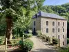
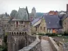
Fougères
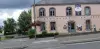
| Municipality | La Pellerine |
|---|---|
| Postcode | 53220 |
| Latitude | 48.3150710 (N 48° 18’ 54”) |
| Longitude | -1.0524860 (W 1° 3’ 9”) |
| Altitude | From 158m to 236m |
| Surface area | 8.18 km² |
| Population | 308 inhabitants |
| Density | 37 inhabitants/km² |
| Prefecture | Laval (40 km, 44 min) |
| Insee code | 53177 |
| Intercommunality | CC de l'Ernée |
| Department | Mayenne |
| Territory | Maine |
| Region | Pays de la Loire |
| Saint-Pierre-des-Landes | 5.5 km (9 min) |
|---|---|
| Fleurigné | 6.3 km (6 min) |
| La Selle-en-Luitré | 6.4 km (9 min) |
| La Chapelle-Janson | 6.8 km (8 min) |
| Luitré-Dompierre | 7.2 km (10 min) |
| Larchamp | 7.5 km (12 min) |
| Beaucé | 8.9 km (8 min) |
| Ernée | 9 km (10 min) |
| Montaudin | 10.5 km (16 min) |
| Juvigné | 10.7 km (17 min) |
| Laignelet | 12.4 km (14 min) |
| Saint-Ellier-du-Maine | 13.5 km (20 min) |
| Montenay | 13.6 km (15 min) |
| Le Loroux | 13.7 km (18 min) |
| Leisure centres |
|---|
| Last name | Activity type | Rate | City |
|---|---|---|---|
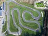 | Sports sensations | 16 € to 24 € | Le Neufbourg (40 km) |
 | Sports sensations | 100 € | Le Val-Saint-Père (46 km) |
 | Sports sensations | 140 € | Le Val-Saint-Père (46 km) |
| Last name | Outing type | Difficulty | Duration | Departure municipality |
|---|---|---|---|---|
 | Hike | Intermediate | 2:10 | La Bouëxière (32 km) |
 | Cycling itinerary | Intermediate | 5:00 | Soucé (33 km) |
 | Car itinerary | Easy | 4:00 | Saint-Cyr-du-Bailleul (33 km) |
 | Hike | Intermediate | 2:00 | Ercé-près-Liffré (35 km) |
 | Hike | Easy | 2:00 | Liffré (39 km) |