Liven up your holidays!

La Chapelle-de-Guinchay

Tourism, holidays & weekends guide in the Saône-et-Loire

La Chapelle-de-Guinchay - Tourism, holidays & weekends guide in the Saône-et-Loire
8.8
6

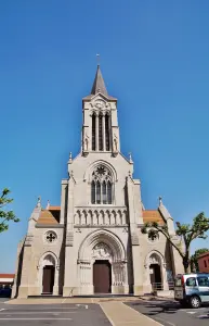
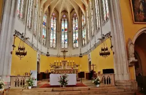
According to history, a lord named Quintus created a small farm farmed by settlers. The farm took the name of its owner and Villa Quintus (or 'Quintio') became due to 'Quincheys' and 'Quinchay' alterations. Later, a chapel was erected: the chapel Sainte Marie de Quinchay. And, over time, it became La Chapelle de Guinchay.

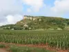
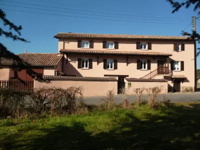
This village located 12 km from Mâcon, at the limit of the departments of Ain, Rhone, Saone-et-Loire, is the chief town of the following towns: Bourgvilain, Brandon, Chaintré, Chaânes, Chasselas, Clairmain, Crêches-sur-Saône, Davayé, Dompierre-les-Ormes, Fuissé, Germolles-sur-Grosne, Mont-de-Mont-de-France Chapel, Leynes, Matour, Montagny-sur-Grosse, Montmelard, Pierreclos, Pruzilly, Romanèche- Thorins, Saint-Amour-Bellevue, Saint-Léger-sous-la-Bussière, Saint-Pierre-le-Vieux, Saint-Point, Saint-Symphorien-d'Ancelles, Saint-Vérand, Serrières, Solutré-Pouilly, Trambly, Trivy, Vergisson, Verosvres, and Vinzelles.

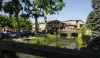
It has nearly 4000 inhabitants, covers an area of ​​1250 hectares and is 200 m above sea level.

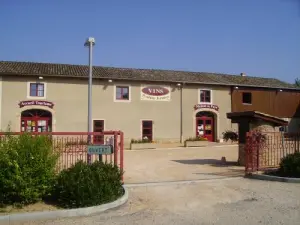
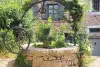
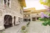
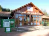
La Chapelle-de-Guinchay has an important professional, commercial and craft life. The equipment necessary for communal life is well adapted (day-care center, school, college, retirement home, gendarmerie, first aid center, post office, pharmacy, public treasury...). The associative, cultural, sports and social life is very active (more than 30 associations).

Geographical information

MunicipalityLa Chapelle-de-Guinchay
Postcode71570
Latitude46.2113210 (N 46° 12’ 41”)
Longitude4.7554020 (E 4° 45’ 19”)
AltitudeFrom 168m to 295m
Surface area12.44 km²
Population4209 inhabitants
Density338 inhabitants/km²
PrefectureMâcon (14.5 km, 22 min)
Insee code71090
IntercommunalityCA Mâconnais Beaujolais Agglomération
DepartmentSaône-et-Loire
TerritoryBurgundy
RegionBurgundy-Franche-Comté

Nearest cities & towns

Saint-Symphorien-d'Ancelles3.6 km (6 min)
Romanèche-Thorins3.6 km (6 min)
Chénas3.6 km (6 min)
Saint-Amour-Bellevue4.8 km (8 min)
Juliénas5.1 km (7 min)
Crêches-sur-Saône6.1 km (8 min)
Chânes6.1 km (9 min)
Fleurie7.5 km (12 min)
Chaintré7.5 km (12 min)
Saint-Vérand8 km (13 min)
Jullié8.5 km (12 min)
Lancié8.7 km (11 min)
Leynes9.2 km (13 min)
Émeringes9.3 km (14 min)

Things to see and do

Places of interest

Transport

Events and festivities

Les Ateliers du vin – Verticale de Moulin-à-Vent
Job Dating
Marché Nocturne

Photos

The town
The town
See photo
The town hall
The town hall
See photo
Fountain
Fountain
See photo
Country House
Country House
See photo
The village
The village
See photo
The monument to the dead
See photo
The village
The village
See photo
The village
The village
See photo
The village
The village
See photo
The village
The village
See photo
Fountain
Fountain
See photo
The Notre-Dame church
See photo
The Notre-Dame church
See photo
The interior of Notre-Dame church
See photo
The interior of Notre-Dame church
See photo
The interior of Notre-Dame church
See photo

Weather

Tuesday 23 april
Min. 2°C - Max. 10°C
Day
Night
Wednesday 24 april
Min. 4°C - Max. 10°C
Day
Night
Thursday 25 april
Min. 3°C - Max. 12°C
Day
Night

Visits, leisure and activities nearby

Leisure activities

Last nameActivity typeRateCity
Visit to the castle of Alphonse de Lamartine
Culture and education10 € Saint-Point (18.2 km)
Horse ride in Green Beaujolais
Nature and the great outdoors50 € to 220 € Chamelet (33 km)
Canoe hire on the Saône
Sports sensations9 € to 20 € Tournus (41 km)
Outdoor show: Walking with witches
Entertainment17 € Pérouges (47 km)
Dramatised tour: Medieval immersion in Pérouges
Culture and education36 € Pérouges (47 km)

Outings

Last nameOuting typeDifficultyDurationDeparture municipality
Solutré Rock
HikeEasy1:00Solutré-Pouilly (10 km)
Mountain bike tour to discover the Val de Saône
All-terrain bike itineraryEasy50 minMontmerle-sur-Saône (14.7 km)
Motorcycle Tour High Beaujolais
Motorbike itineraryIntermediate1:30Les Ardillats (16.8 km)
Tour of Mont Chonay
HikeEasy1:50Deux-Grosnes (16.8 km)
Hiking Between pleasure of the eyes and taste buds
HikeEasy3:35Vonnas (18.2 km)

Restaurants

Bed & breakfasts

Vacation rentals

Campsites

Hotels

Your holidays
A hotel
A vacation rental
A bed & breakfast
A campsite
A leisure activity
A restaurant
A rental car
A plane ticket
By continuing to browse our site, you are agreeing to the use of cookies to improve your experience and make targeted offers.
Find out more and make settings
Your account