

Favourite
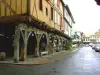
Les Forges de Pyrène
| Municipality | L'Herm |
|---|---|
| Postcode | 09000 |
| Latitude | 42.9728370 (N 42° 58’ 22”) |
| Longitude | 1.6853150 (E 1° 41’ 7”) |
| Altitude | From 411m to 960m |
| Surface area | 14.67 km² |
| Population | 222 inhabitants |
| Density | 15 inhabitants/km² |
| Prefecture | Foix (9.3 km, 14 min) |
| Insee code | 09138 |
| Intercommunality | CA Pays Foix-Varilhes |
| Department | Ariège |
| Territories | Midi-Pyrénées, Pyrenees |
| Region | Occitanie |
| Arabaux | 5.1 km (9 min) |
|---|---|
| Gudas | 6.1 km (11 min) |
| Pradières | 6.3 km (12 min) |
| Soula | 6.5 km (21 min) |
| Roquefort-les-Cascades | 8.4 km (13 min) |
| Foix | 9.6 km (14 min) |
| Ventenac | 9.7 km (16 min) |
| Ilhat | 9.9 km (14 min) |
| Dalou | 10 km (16 min) |
| Ferrières-sur-Ariège | 11.6 km (17 min) |
| Carla-de-Roquefort | 11.7 km (16 min) |
| Varilhes | 12.1 km (21 min) |
| Vernajoul | 12.5 km (18 min) |
| Montgailhard | 12.9 km (19 min) |
| Last name | Activity type | Rate | City |
|---|---|---|---|
 | Nature and the great outdoors | 75 € to 576 € | Camarade (36 km) |
 | Sports sensations | 35 € to 40 € | Alet-les-Bains (46 km) |
| Last name | Outing type | Difficulty | Duration | Departure municipality |
|---|---|---|---|---|
 | Mountain bike itinerary | Intermediate | 8:00 | Mirepoix (20 km) |
 | Hike | Intermediate | 2:00 | Belloc (20 km) |
 | Hike | Easy | 4:00 | La Bastide-de-Sérou (21 km) |
 | Hike | Intermediate | 3:30 | Roquefeuil (30 km) |
 | Hike | Intermediate | 3:00 | Roquefort-de-Sault (49 km) |