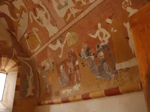
- Monuments: St. Catherine Chapel (murals), Notre Dame, Romanesque base, overlooking the Gartempe.
- The town of Jouhet is located on the classified valley of the Gartempe and the Frescoes of the valley.
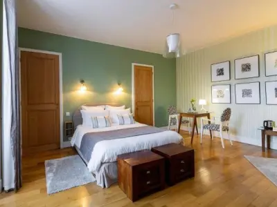
- Restaurant in the town center.


Favourite


| Municipality | Jouhet |
|---|---|
| Postcode | 86500 |
| Latitude | 46.4912710 (N 46° 29’ 29”) |
| Longitude | 0.8382750 (E 0° 50’ 18”) |
| Altitude | From 78m to 153m |
| Surface area | 25.53 km² |
| Population | 533 inhabitants |
| Density | 20 inhabitants/km² |
| Prefecture | Poitiers (44 km, 50 min) |
| Insee code | 86117 |
| Intercommunality | CC Vienne et Gartempe |
| Department | Vienne |
| Territory | Poitou |
| Region | New-Aquitaine |
| Pindray | 2.9 km (5 min) |
|---|---|
| Leignes-sur-Fontaine | 6.1 km (10 min) |
| Antigny | 6.7 km (8 min) |
| Montmorillon | 8.2 km (11 min) |
| Haims | 8.2 km (12 min) |
| Saint-Germain | 9.1 km (11 min) |
| Saint-Savin | 9.8 km (12 min) |
| Chapelle-Viviers | 11.1 km (16 min) |
| Fleix | 13.3 km (20 min) |
| Nalliers | 13.7 km (15 min) |
| Villemort | 13.9 km (16 min) |
| Sillars | 14 km (19 min) |
| Saulgé | 14.3 km (19 min) |
| Journet | 15.8 km (17 min) |
| Natural sites |
|---|


| Last name | Outing type | Difficulty | Duration | Departure municipality |
|---|---|---|---|---|
 | Hike | Easy | 1:10 | Antigny (5.1 km) |
 | Hike | Easy | 55 min | Montmorillon (7.7 km) |
 | All-terrain bike itinerary | Easy | 2:30 | Montmorillon (7.7 km) |
 | Cycling itinerary | Easy | 5:15 | Montmorillon (7.7 km) |
 | Car itinerary | Easy | 30 min | Saint-Savin (8.4 km) |