
Favourite
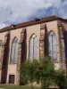
Saint-Quirin
| Municipality | Igney |
|---|---|
| Postcode | 54450 |
| Latitude | 48.6331230 (N 48° 37’ 59”) |
| Longitude | 6.8109540 (E 6° 48’ 39”) |
| Altitude | From 296m to 354m |
| Surface area | 4.71 km² |
| Population | 127 inhabitants |
| Density | 26 inhabitants/km² |
| Prefecture | Nancy (66 km, 45 min) |
| Insee code | 54271 |
| Intercommunality | CC de Vezouze en Piémont |
| Department | Meurthe-et-Moselle |
| Territory | Lorraine |
| Region | Great East |
| Avricourt | 1.5 km (2 min) |
|---|---|
| Amenoncourt | 1.7 km (2 min) |
| Avricourt | 2.3 km (4 min) |
| Repaix | 3.7 km (5 min) |
| Foulcrey | 3.8 km (10 min) |
| Autrepierre | 4 km (6 min) |
| Réchicourt-le-Château | 6.1 km (9 min) |
| Moussey | 6.3 km (7 min) |
| Leintrey | 6.6 km (10 min) |
| Blâmont | 6.7 km (9 min) |
| Gogney | 6.9 km (8 min) |
| Reillon | 7.1 km (12 min) |
| Gondrexon | 7.1 km (10 min) |
| Verdenal | 7.1 km (12 min) |
| Last name | Activity type | Rate | City |
|---|---|---|---|
 | Arts and Crafts | Free | Ranrupt (41 km) |
| Last name | Outing type | Difficulty | Duration | Departure municipality |
|---|---|---|---|---|
 | Hike | Easy | 3:25 | Réchicourt-le-Château (6.1 km) |
 | Hike | Intermediate | 5:25 | Saint-Quirin (18.9 km) |
 | Hike | Easy | 35 min | Sarrebourg (21 km) |
 | Hike | Intermediate | 4:05 | Walscheid (25 km) |
 | Hike | Intermediate | 3:35 | Walscheid (25 km) |