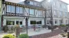
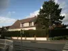
Its church dates from the seventeenth and eighteenth centuries, it is built of brick with very old baptismal font.

Favourite
| Municipality | Halloy |
|---|---|
| Postcode | 60210 |
| Latitude | 49.6548919 (N 49° 39’ 18”) |
| Longitude | 1.9353740 (E 1° 56’ 7”) |
| Altitude | From 187m to 204m |
| Surface area | 3.84 km² |
| Population | 453 inhabitants |
| Density | 117 inhabitants/km² |
| Prefecture | Beauvais (29 km, 35 min) |
| Insee code | 60295 |
| Intercommunality | CC de la Picardie Verte |
| Department | Oise |
| Territory | Picardy |
| Region | Hauts-de-France |
| Briot | 1.6 km (3 min) |
|---|---|
| Grandvilliers | 2 km (4 min) |
| Thieuloy-Saint-Antoine | 2.8 km (4 min) |
| Sarnois | 4.3 km (7 min) |
| Grez | 4.9 km (8 min) |
| Brombos | 5 km (8 min) |
| Cempuis | 5.5 km (8 min) |
| Le Hamel | 5.8 km (7 min) |
| Saint-Maur | 6 km (9 min) |
| Sommereux | 6.1 km (7 min) |
| Prévillers | 7 km (10 min) |
| Daméraucourt | 7 km (10 min) |
| Gaudechart | 7.1 km (8 min) |
| Fontaine-Lavaganne | 7.2 km (8 min) |
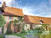
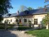
Its church dates from the seventeenth and eighteenth centuries, it is built of brick with very old baptismal font.
| Last name | Outing type | Difficulty | Duration | Departure municipality |
|---|---|---|---|---|
 | Hike | Easy | 3:00 | Courcelles-sous-Moyencourt (19.2 km) |
| Hike | Intermediate | 4:00 | Courcelles-sous-Moyencourt (19.2 km) |
 | Hike | Easy | 50 min | Gournay-en-Bray (24 km) |
 | Hike | Easy | 35 min | Forges-les-Eaux (28 km) |
 | Village visit | Easy | 2:00 | Saint-Maulvis (29 km) |