

Favourite
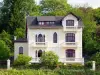
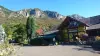
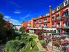
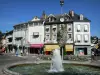
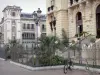
Lourdes
| Municipality | Gez-ez-Angles |
|---|---|
| Postcode | 65100 |
| Latitude | 43.0906990 (N 43° 5’ 27”) |
| Longitude | 0.0237350 (E 0° 1’ 25”) |
| Altitude | From 397m to 721m |
| Surface area | 2.37 km² |
| Population | 27 inhabitants |
| Density | 11 inhabitants/km² |
| Prefecture | Tarbes (23 km, 31 min) |
| Insee code | 65203 |
| Intercommunality | CA Tarbes-Lourdes-Pyrénées |
| Department | Hautes-Pyrénées |
| Territories | Gascony, Midi-Pyrénées, Pyrenees |
| Region | Occitanie |
| Arcizac-ez-Angles | 2.1 km (5 min) |
|---|---|
| Les Angles | 3.1 km (7 min) |
| Lézignan | 3.6 km (9 min) |
| Arrayou-Lahitte | 3.8 km (10 min) |
| Escoubès-Pouts | 4.7 km (9 min) |
| Bourréac | 5.7 km (13 min) |
| Jarret | 5.8 km (11 min) |
| Arrodets-ez-Angles | 7.3 km (18 min) |
| Lourdes | 7.3 km (13 min) |
| Ossun-ez-Angles | 7.6 km (18 min) |
| Orincles | 7.9 km (15 min) |
| Paréac | 8 km (15 min) |
| Artigues | 8.5 km (16 min) |
| Loucrup | 8.5 km (13 min) |
| Last name | Activity type | Rate | City |
|---|---|---|---|
 | Culture and education | 200 € to 350 € | Lourdes (5.7 km) |
 | Sports sensations | 39 € to 70 € | Bagnères-de-Bigorre (10.6 km) |
 | Sports sensations | 40 € to 210 € | Argelès-Gazost (13 km) |
 | Sports sensations | 50 € to 75 € | Beaucens (14.4 km) |
 | Sports sensations | 45 € | Campan (15.1 km) |
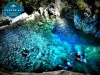
| Last name | Outing type | Difficulty | Duration | Departure municipality |
|---|---|---|---|---|
 | Hike | Easy | 5:25 | Lourdes (4.6 km) |
 | Hike | Easy | 1:00 | Germs-sur-l'Oussouet (5.1 km) |
 | Hike | Intermediate | 2:35 | Lourdes (5.6 km) |
 | Hike | Easy | 35 min | Lourdes (5.7 km) |
 | Hike | Intermediate | 2:25 | Bagnères-de-Bigorre (9.8 km) |