


Favourite
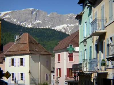
Saint-Bonnet-en-Champsaur
| Municipality | Forest-Saint-Julien |
|---|---|
| Postcode | 05260 |
| Latitude | 44.6452570 (N 44° 38’ 43”) |
| Longitude | 6.1314840 (E 6° 7’ 53”) |
| Altitude | From 1015m to 1631m |
| Surface area | 6.95 km² |
| Population | 341 inhabitants |
| Density | 49 inhabitants/km² |
| Prefecture | Gap (17.4 km, 19 min) |
| Insee code | 05056 |
| Intercommunality | CC Champsaur-Valgaudemar |
| Department | Hautes-Alpes |
| Territories | Alps, Dauphiné |
| Region | Provence-Alps-French Riviera |
| Saint-Laurent-du-Cros | 2.5 km (3 min) |
|---|---|
| Saint-Julien-en-Champsaur | 2.8 km (5 min) |
| Buissard | 4.3 km (8 min) |
| Chabottes | 5.4 km (8 min) |
| Laye | 5.9 km (7 min) |
| Saint-Léger-les-Mélèzes | 6.4 km (8 min) |
| Ancelle | 7.5 km (11 min) |
| Saint-Bonnet-en-Champsaur | 7.8 km (10 min) |
| La Fare-en-Champsaur | 8 km (10 min) |
| La Rochette | 9 km (12 min) |
| Saint-Michel-de-Chaillol | 9.2 km (15 min) |
| Saint-Jean-Saint-Nicolas | 9.2 km (11 min) |
| Poligny | 9.6 km (12 min) |
| Le Noyer | 13.5 km (18 min) |
| Last name | Activity type | Rate | City |
|---|---|---|---|
 | Nature and the great outdoors | 200 € to 1100 € | Ancelle (6.4 km) |
 | Sports sensations | 44 € | Ubaye-Serre-Ponçon (29 km) |
 | Sports sensations | 85 € to 115 € | Ubaye-Serre-Ponçon (29 km) |
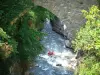 | Sports sensations | 45 € to 85 € | Le Lauzet-Ubaye (33 km) |
 | Sports sensations | 38 € | Saint-Clément-sur-Durance (36 km) |
| Last name | Outing type | Difficulty | Duration | Departure municipality |
|---|---|---|---|---|
 | Hike | Easy | 3:00 | Saint-Laurent-du-Cros (1.7 km) |
| Car itinerary | Easy | 4:00 | Ancelle (6.3 km) |
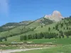 | Hike | Athletic | 3:00 | Ancelle (6.3 km) |
| Hike | Intermediate | 4:30 | Ancelle (6.3 km) |
 | Hike | Intermediate | 5:00 | Ancelle (6.3 km) |