


Favourite
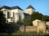
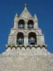
The Nouaillé-Maupertuis abbey
| Municipality | Fleuré |
|---|---|
| Postcode | 86340 |
| Latitude | 46.4784950 (N 46° 28’ 43”) |
| Longitude | 0.5199440 (E 0° 31’ 12”) |
| Altitude | From 98m to 136m |
| Surface area | 16.68 km² |
| Population | 1059 inhabitants |
| Density | 63 inhabitants/km² |
| Prefecture | Poitiers (24 km, 29 min) |
| Insee code | 86099 |
| Intercommunality | CC des Vallées du Clain |
| Department | Vienne |
| Territory | Poitou |
| Region | New-Aquitaine |
| Dienné | 5 km (8 min) |
|---|---|
| Nieuil-l'Espoir | 5.7 km (8 min) |
| Vernon | 5.9 km (7 min) |
| Tercé | 6 km (6 min) |
| Lhommaizé | 7.9 km (9 min) |
| Pouillé | 8.5 km (9 min) |
| Savigny-Lévescault | 9.7 km (10 min) |
| Verrières | 10.1 km (11 min) |
| Gizay | 10.3 km (13 min) |
| Mignaloux-Beauvoir | 11.5 km (9 min) |
| Saint-Julien-l'Ars | 11.9 km (10 min) |
| Nouaillé-Maupertuis | 11.9 km (12 min) |
| Valdivienne | 12.1 km (14 min) |
| Jardres | 12.5 km (15 min) |
| Last name | Outing type | Difficulty | Duration | Departure municipality |
|---|---|---|---|---|
 | All-terrain bike itinerary | Easy | 2:30 | Lussac-les-Châteaux (17.8 km) |
 | All-terrain bike itinerary | Easy | 3:20 | Lussac-les-Châteaux (17.8 km) |
 | Hike | Easy | 40 min | Lussac-les-Châteaux (17.8 km) |
 | Hike | Easy | 1:10 | Antigny (26 km) |
 | Hike | Easy | 55 min | Montmorillon (27 km) |