Favourite
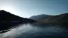
La Clusaz
| Municipality | Etaux |
|---|---|
| Postcode | 74800 |
| Latitude | 46.0656050 (N 46° 3’ 56”) |
| Longitude | 6.2941440 (E 6° 17’ 39”) |
| Altitude | From 580m to 922m |
| Surface area | 13.69 km² |
| Population | 2105 inhabitants |
| Density | 153 inhabitants/km² |
| Prefecture | Annecy (33 km, 27 min) |
| Insee code | 74116 |
| Intercommunality | CC du Pays Rochois |
| Department | Haute-Savoie |
| Territory | Alps |
| Region | Auvergne-Rhône-Alps |
| La Roche-sur-Foron | 1.9 km (5 min) |
|---|---|
| Saint-Sixt | 4.6 km (11 min) |
| Cornier | 5 km (8 min) |
| Amancy | 5.8 km (9 min) |
| Saint-Laurent | 6.6 km (12 min) |
| Pers-Jussy | 6.9 km (11 min) |
| La Chapelle-Rambaud | 7 km (11 min) |
| Arenthon | 8.5 km (12 min) |
| Scientrier | 9.4 km (13 min) |
| Reignier-Ésery | 9.6 km (11 min) |
| Saint-Pierre-en-Faucigny | 10.8 km (14 min) |
| Bonneville | 12.1 km (18 min) |
| Arthaz-Pont-Notre-Dame | 12.4 km (17 min) |
| Menthonnex-en-Bornes | 12.4 km (15 min) |
| Last name | Activity type | Rate | City |
|---|---|---|---|
 | Nature and the great outdoors | 850 € | Monnetier-Mornex (11.2 km) |
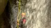 | Sports sensations | 45 € to 60 € | Viuz-en-Sallaz (13.1 km) |
 | Entertainment | 25 € | Cranves-Sales (13.1 km) |
 | Nature and the great outdoors | 35 € | Mont-Saxonnex (14.9 km) |
 | Entertainment | 24 € | Annecy (16.6 km) |
| Last name | Outing type | Difficulty | Duration | Departure municipality |
|---|---|---|---|---|
 | Hike | Easy | 1:30 | Fillinges (11.1 km) |
 | Hike | Intermediate | 4:50 | Mieussy (22 km) |
| Hike | Easy | 1:30 | Ballaison (26 km) |
 | Hike | Intermediate | 4:45 | Péron (31 km) |
| Hike | Intermediate | 3:30 | Lathuile (32 km) |