Liven up your holidays!

Elliant

Tourism, holidays & weekends guide in the Finistère

Elliant - Tourism, holidays & weekends guide in the Finistère
8.0
3

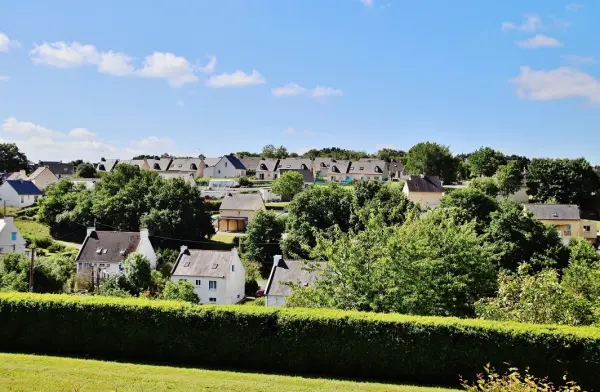
A land marked by the imprint Valley Jet which has shaped an undulating landscape, diversity is everywhere. Elliant stood out from other municipalities for its strong cultural particularity, the essence of Country Melenik distinguished by a unique costume. It is a common agricultural and handicraft.

Geographical information

MunicipalityElliant
Postcode29370
Tourism label
Latitude47.9952180 (N 47° 59’ 43”)
Longitude-3.8903650 (W 3° 53’ 25”)
AltitudeFrom 31m to 187m
Surface area70.30 km²
Population3471 inhabitants
Density49 inhabitants/km²
PrefectureQuimper (16.8 km, 23 min)
Insee code29049
IntercommunalityCA Concarneau Cornouaille Agglomération
DepartmentFinistère
RegionBrittany

Nearest cities & towns

Saint-Yvi5.8 km (10 min)
Rosporden6.7 km (10 min)
Langolen10.7 km (13 min)
Ergué-Gabéric12.2 km (14 min)
Tourch12.6 km (14 min)
Melgven13.1 km (15 min)
Coray13.3 km (13 min)
Saint-Évarzec15.4 km (19 min)
Quimper16.9 km (18 min)
Bannalec17.6 km (22 min)
Landudal18.5 km (20 min)
Leuhan19.2 km (20 min)
Edern19.2 km (22 min)
Concarneau19.2 km (23 min)

Things to see and do

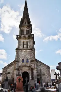
Place of human life since prehistoric times, this large territory that was Elgent in the year one thousand has visible traces of a remote past: megaliths (around 3000 years BC), several Gallic steles (750 to 50 BC), Gallo-Roman remains, chapels (four). The church tower is listed as a Historic Monument.

The hiking trails, mills, fountains, crosses and wayside crosses bear witness to an abundant wealth of heritage, many of which are accessible and lively during the summer.

Leisure and activities: football pitch, tennis, outdoor municipal swimming pool heated in summer, library, riding school, 1st category fishing.

Places of interest

Leisure centres

Events and festivities

Photos

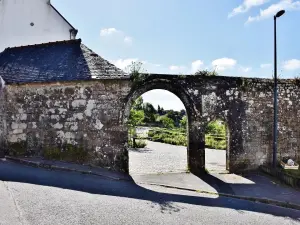
The town
The town
See photo
The town
The town
See photo
The town
The town
See photo
The church
The church
See photo
The church
The church
See photo
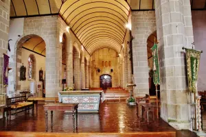
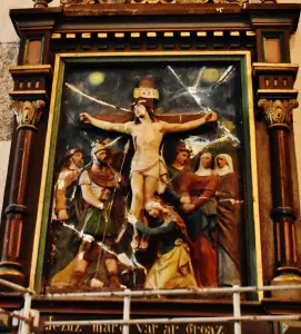
Inside the church
Inside the church
See photo
Inside the church
Inside the church
See photo
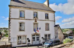
The town hall
The town hall
See photo
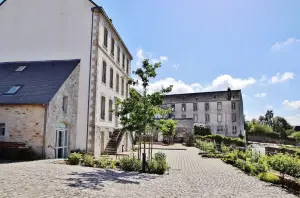
The commune
The commune
See photo
The commune
The commune
See photo
The commune
The commune
See photo
The commune
The commune
See photo
The commune
The commune
See photo
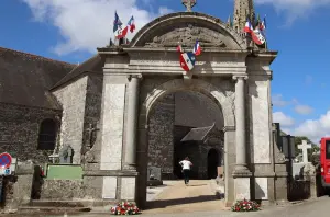
The church
The church
See photo
The church
The church
See photo
The interior of the church
See photo
The 'interior of the church
See photo
The interior of the church
See photo
The war memorial
The war memorial
See photo

Weather

Friday 19 april
Min. 4°C - Max. 16°C
Day
Night
Saturday 20 april
Min. 6°C - Max. 15°C
Day
Night
Sunday 21 april
Min. 4°C - Max. 14°C
Day
Night

Visits, leisure and activities nearby

Outings

Last nameOuting typeDifficultyDurationDeparture municipality
Roche du Feu circuit
HikeIntermediate3:35Gouézec (19.1 km)
Roche du Feu hike - Departure from the village
HikeIntermediate1:30Gouézec (20 km)
Gouézec circuit from Pont-Coblant
HikeIntermediate3:35Gouézec (23 km)
Locmaria to Guiscriff - ​​Circuit # 11
HikeEasy2:30Guiscriff (25 km)
Hent ar Pennglaouig at Lanvénégen - Circuit No.28
HikeEasy55 minLanvénégen (26 km)

Restaurants

Bed & breakfasts

Vacation rentals

Campsites

Hotels

Your holidays
A hotel
A vacation rental
A bed & breakfast
A campsite
A leisure activity
A restaurant
A rental car
A plane ticket
By continuing to browse our site, you are agreeing to the use of cookies to improve your experience and make targeted offers.
Find out more and make settings
Your account