- Features:
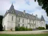
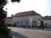
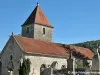
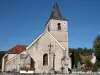
- The church for its architecture and interior paints (listed).
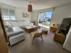
- The wash their different style and good condition.
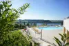
- Two mountain bike, a 12 km (family) and a 32 km (technical and reserved for athletic people).
| Municipality | Dancevoir |
|---|---|
| Postcode | 52210 |
| Latitude | 47.9270840 (N 47° 55’ 38”) |
| Longitude | 4.8742670 (E 4° 52’ 27”) |
| Surface area | 25.58 km² |
| Population | 201 inhabitants |
| Density | 7 inhabitants/km² |
| Prefecture | Chaumont (37 km, 36 min) |
| Insee code | 52165 |
| Intercommunality | CC des Trois Forêts |
| Department | Haute-Marne |
| Territory | Champagne-Ardenne |
| Region | Great East |
| Lignerolles | 3.6 km (7 min) |
|---|---|
| Boudreville | 5.1 km (7 min) |
| Aubepierre-sur-Aube | 5.7 km (7 min) |
| Les Goulles | 6.4 km (9 min) |
| La Chaume | 6.6 km (16 min) |
| Veuxhaulles-sur-Aube | 7.8 km (13 min) |
| Latrecey-Ormoy-sur-Aube | 9.3 km (14 min) |
| Montigny-sur-Aube | 10.1 km (17 min) |
| Coupray | 10.6 km (15 min) |
| Gurgy-la-Ville | 10.9 km (13 min) |
| Lucey | 11.5 km (20 min) |
| Courban | 12.7 km (15 min) |
| Louesme | 12.8 km (14 min) |
| Last name | Activity type | Rate | City |
|---|---|---|---|
 | Entertainment | 30 € to 40 € | Ville-sur-Arce (37 km) |
| Last name | Outing type | Difficulty | Duration | Departure municipality |
|---|---|---|---|---|
 | Cycling itinerary | Easy | 2:10 | Arc-en-Barrois (10.4 km) |
 | Hike | Easy | 3:05 | Saint-Loup-sur-Aujon (16.6 km) |
 | Cycling itinerary | Intermediate | 4:15 | Auberive (20 km) |
 | Hike | Easy | 4:10 | Villars-Santenoge (21 km) |
 | Hike | Easy | 3:25 | Villars-Santenoge (21 km) |