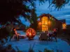

Favourite
Lorraine faience pottery
| Municipality | Cutting |
|---|---|
| Postcode | 57260 |
| Latitude | 48.8489680 (N 48° 50’ 56”) |
| Longitude | 6.8347710 (E 6° 50’ 5”) |
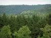
| Altitude | From 213m to 256m |
| Surface area | 5.62 km² |
| Population | 106 inhabitants |
| Density | 18 inhabitants/km² |
| Prefecture | Metz (70 km, 1:15) |
| Insee code | 57161 |
| Intercommunality | CC du Saulnois |
| Department | Moselle |
| Territory | Lorraine |
| Region | Great East |
| Lostroff | 1.9 km (3 min) |
|---|---|
| Rorbach-lès-Dieuze | 2.3 km (4 min) |
| Domnom-lès-Dieuze | 2.4 km (4 min) |
| Bassing | 4.2 km (6 min) |
| Loudrefing | 4.7 km (5 min) |
| Guinzeling | 4.8 km (7 min) |
| Zommange | 4.8 km (8 min) |
| Molring | 7 km (11 min) |
| Marimont-lès-Bénestroff | 7 km (9 min) |
| Lhor | 7.2 km (11 min) |
| Bourgaltroff | 7.8 km (11 min) |
| Bidestroff | 7.9 km (11 min) |
| Belles-Forêts | 8.2 km (11 min) |
| Torcheville | 8.5 km (13 min) |
| Last name | Outing type | Difficulty | Duration | Departure municipality |
|---|---|---|---|---|
 | Hike | Easy | 3:25 | Réchicourt-le-Château (18.1 km) |
 | Hike | Easy | 35 min | Sarrebourg (20 km) |
 | Cycling itinerary | Easy | 4:00 | Lorentzen (27 km) |
| Hike | Easy | 2:00 | Diemeringen (28 km) |
 | Hike | Intermediate | 5:25 | Saint-Quirin (31 km) |