

Favourite
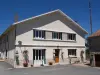
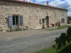
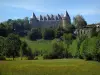
Confolens
| Municipality | Chirac |
|---|---|
| Postcode | 16150 |
| Latitude | 45.9139300 (N 45° 54’ 50”) |
| Longitude | 0.6542690 (E 0° 39’ 15”) |
| Altitude | From 133m to 263m |
| Surface area | 34.33 km² |
| Population | 789 inhabitants |
| Density | 22 inhabitants/km² |
| Prefecture | Angoulême (59 km, 1:02) |
| Insee code | 16100 |
| Intercommunality | CC de Charente Limousine |
| Department | Charente |
| Territory | Charentes |
| Region | New-Aquitaine |
| Manot | 4.3 km (7 min) |
|---|---|
| Exideuil-sur-Vienne | 4.3 km (7 min) |
| Chabanais | 6.9 km (11 min) |
| Saint-Maurice-des-Lions | 9.2 km (14 min) |
| Ansac-sur-Vienne | 10.1 km (15 min) |
| Saint-Quentin-sur-Charente | 10.1 km (16 min) |
| Saulgond | 12.3 km (21 min) |
| Confolens | 12.6 km (19 min) |
| Étagnac | 12.8 km (17 min) |
| Chabrac | 13 km (16 min) |
| Chassenon | 13.2 km (20 min) |
| Pressignac | 13.8 km (22 min) |
| Ambernac | 13.9 km (21 min) |
| Terres-de-Haute-Charente | 14.1 km (17 min) |
| Last name | Activity type | Rate | City |
|---|---|---|---|
 | Entertainment | 52 € to 84 € | La Rochefoucauld-en-Angoumois (28 km) |
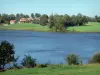
| Last name | Outing type | Difficulty | Duration | Departure municipality |
|---|---|---|---|---|
 | Hike | Intermediate | 55 min | Availles-Limouzine (23 km) |
 | Car itinerary | Easy | 55 min | Availles-Limouzine (23 km) |
 | Hike | Intermediate | 4:15 | Montrol-Sénard (27 km) |
 | Hike | Easy | 1:30 | Eymouthiers (31 km) |
 | Hike | Easy | 4:00 | Gorre (32 km) |