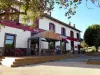
Favourite
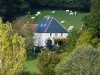
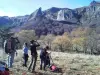
Queuille meander


| Municipality | Charensat |
|---|---|
| Postcode | 63640 |
| Latitude | 45.9863570 (N 45° 59’ 11”) |
| Longitude | 2.6381660 (E 2° 38’ 17”) |
| Altitude | From 546m to 764m |
| Surface area | 46.68 km² |
| Population | 485 inhabitants |
| Density | 10 inhabitants/km² |
| Prefecture | Clermont-Ferrand (58 km, 1:08) |
| Insee code | 63094 |
| Intercommunality | CC du Pays de Saint-Éloy |
| Department | Puy-de-Dôme |
| Territories | Auvergne, Massif Central |
| Region | Auvergne-Rhône-Alps |
| Biollet | 4.6 km (8 min) |
|---|---|
| Dontreix | 7 km (11 min) |
| Vergheas | 9 km (13 min) |
| Montel-de-Gelat | 9 km (12 min) |
| Villossanges | 9.7 km (14 min) |
| Espinasse | 9.8 km (13 min) |
| Roche-d'Agoux | 11.8 km (17 min) |
| Saint-Priest-des-Champs | 12.1 km (17 min) |
| Saint-Julien-la-Geneste | 12.3 km (16 min) |
| Saint-Maurice-près-Pionsat | 13.8 km (21 min) |
| Tralaigues | 13.8 km (18 min) |
| Bussières | 14.8 km (23 min) |
| Auzances | 15.6 km (22 min) |
| Miremont | 15.7 km (22 min) |

| Last name | Activity type | Rate | City |
|---|---|---|---|
 | Nature and the great outdoors | 7 € | Chapdes-Beaufort (20 km) |
 | Nature and the great outdoors | 140 € to 240 € | Volvic (33 km) |
| Last name | Outing type | Difficulty | Duration | Departure municipality |
|---|---|---|---|---|
 | Cycling itinerary | Intermediate | 4:35 | Miremont (11.3 km) |
 | Hike | Easy | 2:00 | Évaux-les-Bains (24 km) |
 | Hike | Intermediate | 2:20 | Évaux-les-Bains (24 km) |
 | Car itinerary | Easy | 1:35 | Évaux-les-Bains (24 km) |
 | Hike | Intermediate | 1:30 | Saint-Rémy-de-Blot (25 km) |