


Favourite
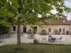
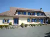
Nogent-le-Rotrou
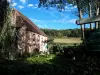
| Municipality | Champrond-en-Perchet |
|---|---|
| Postcode | 28400 |
| Latitude | 48.3113889 (N 48° 18’ 41”) |
| Longitude | 0.8691667 (E 0° 52’ 9”) |
| Altitude | From 145m to 236m |
| Surface area | 9.02 km² |
| Population | 417 inhabitants |
| Density | 46 inhabitants/km² |
| Prefecture | Chartres (64 km, 52 min) |
| Insee code | 28072 |
| Intercommunality | CC du Perche |
| Department | Eure-et-Loir |
| Territory | Perche |
| Region | Centre-Loire Valley |
| Trizay-Coutretot-Saint-Serge | 2.9 km (6 min) |
|---|---|
| Nogent-le-Rotrou | 3.9 km (6 min) |
| La Gaudaine | 5.3 km (8 min) |
| Arcisses | 6.2 km (11 min) |
| Saint-Jean-Pierre-Fixte | 6.6 km (12 min) |
| Vichères | 7.1 km (12 min) |
| Souancé-au-Perche | 9 km (13 min) |
| Argenvilliers | 9.8 km (16 min) |
| Saint-Pierre-la-Bruyère | 10.1 km (17 min) |
| Thiron-Gardais | 10.4 km (11 min) |
| Berd'huis | 10.4 km (15 min) |
| Coudray-au-Perche | 10.8 km (18 min) |
| Saintigny | 10.8 km (14 min) |
| Saint-Hilaire-sur-Erre | 11.6 km (18 min) |
| Last name | Activity type | Rate | City |
|---|---|---|---|
 | Sports sensations | 22 € to 75 € | Fontaine-Simon (25 km) |
| Last name | Outing type | Difficulty | Duration | Departure municipality |
|---|---|---|---|---|
 | Hike | Intermediate | 2:45 | Nonvilliers-Grandhoux (22 km) |
 | Hike | Easy | 55 min | Bonnétable (37 km) |
 | Hike | Easy | 3:45 | Jauzé (38 km) |
 | Hike | Easy | 3:25 | Saint-Longis (38 km) |
 | Village visit | Easy | 1:00 | Châteaudun (43 km) |