Chamousset is a locality in the Auvergne-Rhône-Alpes region of Savoie, 30 kilometers east of Chambéry and 20 kilometers south-west of Albertville.
The communal territory which covers only 6 km² ranges from 280 to 325 m altitude and is located in the heart of the natural region of the Combe de Savoie, a valley long considered a strategic axis between the Italian Po plain and the French Rhone Valley. La Combe de Savoie is now the gateway to the alpine resorts.
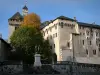
On the borders of the Savoyard vineyards, Chamousset is the confluence of the Arc and Isère rivers. The village developed on the heights of the once fortified hill, but the castle of local lords, a time high to the rank of marquis, was destroyed in the late sixteenth century.
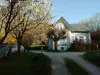
The long agricultural activity (breeding, tobacco cultivation) is now open to handicrafts and the growth of tourism has allowed the town, which has about 600 inhabitants, to stop the rural exodus, new dwellings being built in the lower part of the territory along the lines of communication.
Chamousset is a step now appreciated for who goes to the neighboring stations.
The village has an interesting historical heritage to discover via a walk that begins with the church of St. Maurice. Its construction began in 1716 and the church was opened to worship in 1751. Its style is related to late Baroque but its originality is its cruciform plan (also called clover) which earned it a historical monument. The entrance portal is framed by two pilasters. Inside, the main altar is surmounted by an altarpiece whose central table has been recently restored. From the choir, at the end of the central apse, one door leads to the sacristy and another leads to the belfry. Side chapels and stained glass windows are also worthy of note.
If it remains of the castle only some vestiges, whose bases, they are works of art which constitute the other parts of the classified heritage of Chamousset: the royal bridge inaugurated on Isère in 1855 and the hydraulic tunnel which allows avoid the floods of the Gelon.
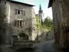
Finally, in the old village, there are barns and traditional barns that have been renovated and converted into dwelling houses.
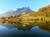
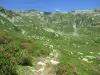
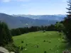
In terms of natural heritage, besides the banks of the Isere, it is from the heights of the town that we will appreciate the viewpoints overlooking the Combe de Savoie to Maurienne and Tarentaise.
For hikes including the village, its sites of interest, and including incursions in the near vineyard, documentation and information at +33 4 79 36 43 28 or 0820 00 73 74.
Note also that a bike park and petanque are available to residents and visitors. It is the same for the tennis court: inquire at +33 4 79 36 43 28.
As for the fishing amateurs, they can contact the +33 4 79 85 89 36 to know the sites adapted to their favorite leisure and the regulation to be respected.