Abandoned village of Montchauvet to Saugues.


Favourite


| Municipality | Bel-Air-Val-d'Ance |
|---|---|
| Postcode | 48600 |
| Latitude | 44.8531140 (N 44° 51’ 11”) |
| Longitude | 3.6596080 (E 3° 39’ 35”) |
| Altitude | From 891m to 1237m |
| Surface area | 41.40 km² |
| Population | 552 inhabitants |
| Density | 13 inhabitants/km² |
| Prefecture | Mende (56 km, 1:01) |
| Insee code | 48038 |
| Intercommunality | CC du Haut Allier |
| Department | Lozère |
| Territories | Languedoc-Roussillon, Massif Central |
| Region | Occitanie |
| Saint-Vénérand | 3.7 km (6 min) |
|---|---|
| Saint-Christophe-d'Allier | 5.1 km (9 min) |
| Saint-Préjet-d'Allier | 10.1 km (17 min) |
| Grandrieu | 11.1 km (15 min) |
| Saint Bonnet-Laval | 11.4 km (17 min) |
| Saint-Paul-le-Froid | 12.9 km (20 min) |
| Thoras | 13.5 km (18 min) |
| Saint-Haon | 13.6 km (21 min) |
| Esplantas-Vazeilles | 16.2 km (18 min) |
| Auroux | 16.8 km (24 min) |
| Alleyras | 17.5 km (25 min) |
| Monistrol-d'Allier | 18.1 km (27 min) |
| Le Bouchet-Saint-Nicolas | 19.6 km (27 min) |
| Rauret | 19.8 km (29 min) |


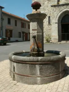


Abandoned village of Montchauvet to Saugues.
| Last name | Outing type | Difficulty | Duration | Departure municipality |
|---|---|---|---|---|
 | Hike | Easy | 1:30 | Cayres (12.6 km) |
 | Hike | Easy | 2:00 | Cayres (12.6 km) |
 | Hike | Easy | 2:30 | Cayres (14.2 km) |
 | Hike | Intermediate | 4:00 | Cayres (14.4 km) |
 | Hike | Easy | 45 min | Langogne (21 km) |