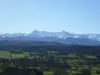
Located 15 km northeast of Tarbes and 6 km from Pouyastruc, the town is built largely on a ridge perpendicular to the Pyrenees, whose highest point is 340 m above sea level.
Total area: 655 hectares including 172 hectares of private and communal forest.
Bouilh-Péreuilh result of the meeting of the villages of Bouilh-Darre and Péreuilh in 1830, which is the distance of both high and low areas.
The origin of the names "Bouilh" and "Péreuilh" are not very safe. They could come from "ox barn" for Bouilh and "pear" to Péreuilh.
Before reunification, Bouilh-Darre residents called themselves "Bouilhots" but we have nothing for the ancient inhabitants of Péreuilh, prompting us to call the current residents "Bouilhots Péreuilhés".
Since the early nineteenth century its population has steadily decreased from 320 people to 62 179 households in 1911 to 49 homes and 111 people finally identified in 2019.
The population lived mainly from agriculture and livestock, producing cereals, potatoes and grapes giving excellent white wine. It remains today no more vine following the ravages of phylloxera.