

Favourite
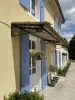
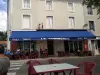
Ruffec
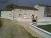
| Municipality | Bernac |
|---|---|
| Postcode | 16700 |
| Latitude | 46.0460900 (N 46° 2’ 46”) |
| Longitude | 0.1747030 (E 0° 10’ 29”) |
| Altitude | From 94m to 152m |
| Surface area | 8.46 km² |
| Population | 484 inhabitants |
| Density | 57 inhabitants/km² |
| Prefecture | Angoulême (50 km, 39 min) |
| Insee code | 16039 |
| Intercommunality | CC Val de Charente |
| Department | Charente |
| Territory | Charentes |
| Region | New-Aquitaine |
| Saint-Martin-du-Clocher | 3.2 km (7 min) |
|---|---|
| La Chèvrerie | 3.8 km (6 min) |
| Ruffec | 4.2 km (9 min) |
| Les Adjots | 5.6 km (9 min) |
| La Faye | 6.3 km (8 min) |
| Villiers-le-Roux | 6.4 km (10 min) |
| Condac | 6.4 km (11 min) |
| Londigny | 7.4 km (11 min) |
| Montjean | 7.4 km (8 min) |
| Taizé-Aizie | 8.9 km (16 min) |
| Montalembert | 9.1 km (13 min) |
| Courcôme | 9.6 km (10 min) |
| La Magdeleine | 9.7 km (16 min) |
| La Forêt-de-Tessé | 10.1 km (13 min) |
| Last name | Activity type | Rate | City |
|---|---|---|---|
 | Entertainment | 52 € to 84 € | La Rochefoucauld-en-Angoumois (38 km) |
 | Local flavours | Free | Graves-Saint-Amant (49 km) |
| Last name | Outing type | Difficulty | Duration | Departure municipality |
|---|---|---|---|---|
 | Hike | Easy | 1:00 | Mons (24 km) |
 | Hike | Easy | 3:20 | Saint-Martin-l'Ars (34 km) |
 | Car itinerary | Easy | 55 min | Availles-Limouzine (38 km) |
 | Hike | Intermediate | 55 min | Availles-Limouzine (38 km) |
 | Village visit | Easy | 1:30 | Bunzac (41 km) |