


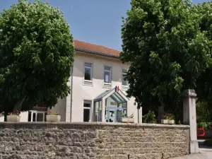
Favourite
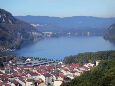
Nantua Lake


| Municipality | Béard-Géovreissiat |
|---|---|
| Postcode | 01460 |
| Latitude | 46.1905556 (N 46° 11’ 26”) |
| Longitude | 5.5575000 (E 5° 33’ 27”) |
| Altitude | From 446m to 724m |
| Surface area | 4.69 km² |
| Population | 1071 inhabitants |
| Density | 228 inhabitants/km² |
| Prefecture | Bourg-en-Bresse (50 km, 41 min) |
| Insee code | 01170 |
| Intercommunality | CA Haut - Bugey Agglomération |
| Department | Ain |
| Territories | Alps, Jura mountains |
| Region | Auvergne-Rhône-Alps |
| Brion | 3.7 km (10 min) |
|---|---|
| Izernore | 5.1 km (9 min) |
| Montréal-la-Cluse | 5.1 km (12 min) |
| Port | 5.3 km (11 min) |
| Nurieux-Volognat | 6 km (11 min) |
| Nantua | 7.7 km (12 min) |
| Saint-Martin-du-Frêne | 8.2 km (13 min) |
| Peyriat | 8.5 km (17 min) |
| Sonthonnax-la-Montagne | 8.8 km (15 min) |
| Martignat | 10.1 km (16 min) |
| Les Neyrolles | 10.6 km (17 min) |
| Matafelon-Granges | 10.6 km (16 min) |
| Maillat | 10.7 km (14 min) |
| Samognat | 10.8 km (16 min) |


| Last name | Activity type | Rate | City |
|---|---|---|---|
 | Sports sensations | 40 € to 65 € | Saint-Claude (32 km) |
 | Sports sensations | 45 € | Saint-Claude (32 km) |
 | Sports sensations | 37 € | Joudes (35 km) |
 | Culture and education | 36 € | Pérouges (43 km) |
 | Entertainment | 17 € | Pérouges (43 km) |
| Last name | Outing type | Difficulty | Duration | Departure municipality |
|---|---|---|---|---|
 | Hike | Intermediate | 2:15 | Montréal-la-Cluse (2.5 km) |
 | Hike | Easy | 6:20 | Nurieux-Volognat (2.6 km) |
 | Hike | Easy | 2:35 | Nurieux-Volognat (3 km) |
 | Hike | Easy | 3:00 | Izernore (3.3 km) |
 | Hike | Intermediate | 4:35 | Nantua (3.5 km) |


