Favourite
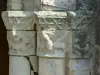
Aulnay-de-Saintonge Church
| Municipality | Bagnizeau |
|---|---|
| Postcode | 17160 |
| Latitude | 45.8833311 (N 45° 52’ 60”) |
| Longitude | -0.3166680 (W 0° 19’ 0”) |
| Altitude | From 40m to 88m |
| Surface area | 9.63 km² |
| Population | 202 inhabitants |
| Density | 20 inhabitants/km² |
| Prefecture | La Rochelle (88 km, 1:20) |
| Insee code | 17029 |
| Intercommunality | CC Vals de Saintonge Communauté |
| Department | Charente-Maritime |
| Territory | Charentes |
| Region | New-Aquitaine |
| Matha | 2.5 km (6 min) |
|---|---|
| Blanzac-lès-Matha | 5 km (8 min) |
| La Brousse | 5.4 km (6 min) |
| Gibourne | 6.5 km (10 min) |
| Haimps | 7.4 km (10 min) |
| Thors | 7.5 km (9 min) |
| Les Touches-de-Périgny | 8.2 km (12 min) |
| Saint-Pierre-de-Juillers | 8.5 km (12 min) |
| Saint-Martin-de-Juillers | 8.5 km (12 min) |
| Sonnac | 9.3 km (12 min) |
| Le Gicq | 9.6 km (11 min) |
| Courcerac | 9.8 km (15 min) |
| Aumagne | 10.1 km (13 min) |
| Massac | 10.2 km (11 min) |
| Monuments |
|---|
| Last name | Activity type | Rate | City |
|---|---|---|---|
 | Sports sensations | 10 € to 20 € | Saint-Bris-des-Bois (16.8 km) |
 | Local flavours | Free | Graves-Saint-Amant (32 km) |
 | Local flavours | Free | La Couronne (43 km) |
| Last name | Outing type | Difficulty | Duration | Departure municipality |
|---|---|---|---|---|
 | Hike | Easy | 1:00 | Mons (24 km) |
 | Hike | Easy | 1:05 | Saintes (29 km) |
 | Hike | Easy | 4:05 | Saintes (30 km) |
 | Hike | Easy | 3:45 | Puyrolland (31 km) |
| Village visit | Easy | 1:00 | Le Gua (52 km) |