

Favourite
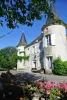
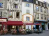
Poitiers
| Municipality | Ayron |
|---|---|
| Postcode | 86190 |
| Latitude | 46.6605070 (N 46° 39’ 38”) |
| Longitude | 0.0758550 (E 0° 4’ 33”) |
| Altitude | From 117m to 169m |
| Surface area | 28.30 km² |
| Population | 1112 inhabitants |
| Density | 39 inhabitants/km² |
| Prefecture | Poitiers (28 km, 31 min) |
| Insee code | 86017 |
| Intercommunality | CC du Haut-Poitou |
| Department | Vienne |
| Territory | Poitou |
| Region | New-Aquitaine |
| Maillé | 2.7 km (6 min) |
|---|---|
| Latillé | 5.1 km (9 min) |
| Frozes | 5.3 km (7 min) |
| Chiré-en-Montreuil | 6 km (9 min) |
| Vouzailles | 6.1 km (10 min) |
| Chalandray | 6.2 km (8 min) |
| Vouillé | 8.7 km (10 min) |
| Champigny en Rochereau | 9.4 km (16 min) |
| Cherves | 9.9 km (15 min) |
| Massognes | 10.9 km (16 min) |
| Villiers | 11 km (12 min) |
| Maisonneuve | 11.1 km (16 min) |
| Thénezay | 11.2 km (15 min) |
| La Ferrière-en-Parthenay | 11.9 km (10 min) |
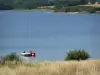
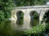
| Natural sites |
|---|
| Last name | Outing type | Difficulty | Duration | Departure municipality |
|---|---|---|---|---|
 | Hike | Easy | 3:00 | Mouterre-Silly (35 km) |
 | Hike | Easy | 2:00 | Ternay (43 km) |
 | Hike | Easy | 1:30 | Nouâtre (56 km) |
 | All-terrain bike itinerary | Easy | 2:30 | Lussac-les-Châteaux (57 km) |
 | All-terrain bike itinerary | Easy | 3:20 | Lussac-les-Châteaux (57 km) |