Favourite
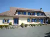
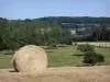
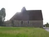
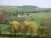
Verneuil-sur-Avre
| Municipality | Armentières-sur-Avre |
|---|---|
| Postcode | 27820 |
| Latitude | 48.6872050 (N 48° 41’ 14”) |
| Longitude | 0.8128450 (E 0° 48’ 46”) |
| Altitude | From 174m to 208m |
| Surface area | 6.11 km² |
| Population | 168 inhabitants |
| Density | 27 inhabitants/km² |
| Prefecture | Evreux (51 km, 54 min) |
| Insee code | 27019 |
| Intercommunality | CC Interco Normandie Sud Eure |
| Department | Eure |
| Region | Normandy |
| Saint-Christophe-sur-Avre | 2.1 km (3 min) |
|---|---|
| Chennebrun | 3.3 km (6 min) |
| Saint-Victor-sur-Avre | 4.4 km (5 min) |
| Rohaire | 4.5 km (7 min) |
| Charencey | 6.2 km (5 min) |
| Gournay-le-Guérin | 6.5 km (11 min) |
| Les Barils | 7.4 km (9 min) |
| Boissy-lès-Perche | 7.8 km (11 min) |
| La Chapelle-Fortin | 8 km (13 min) |
| Pullay | 8.8 km (9 min) |
| Beaulieu | 9 km (9 min) |
| Verneuil d'Avre et d'Iton | 11.4 km (10 min) |
| Irai | 12.7 km (14 min) |
| Last name | Activity type | Rate | City |
|---|---|---|---|
 | Sports sensations | 22 € to 75 € | Fontaine-Simon (25 km) |
| Last name | Outing type | Difficulty | Duration | Departure municipality |
|---|---|---|---|---|
 | Hike | Intermediate | 2:45 | Nonvilliers-Grandhoux (46 km) |
 | Hike | Easy | 2:50 | Mouettes (46 km) |
 | Hike | Easy | 25 min | Ézy-sur-Eure (49 km) |
 | All-terrain bike itinerary | Easy | 1:45 | Anet (50 km) |
 | Hike | Easy | 3:00 | Anet (50 km) |